
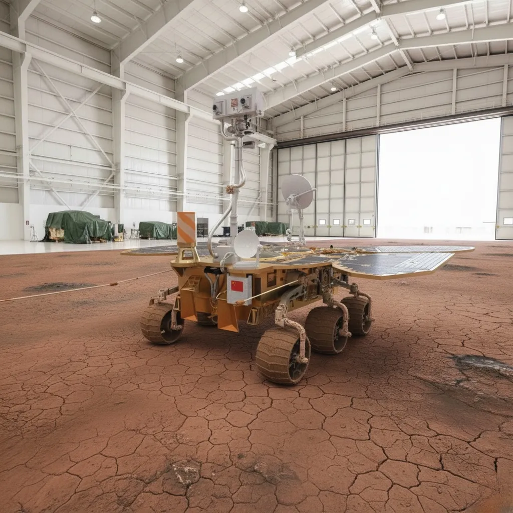
Zhurong
The Zhurong rover operated for 356 sols in Utopia Planitia, traveling 1921 meters. Its radar data revealed deep sedimentary structures, buried paleopolygonal wedges at 35 meters, and tilted littoral layers at 14.5°, confirming a humid past and an ancient ocean in northern Mars.
Agency

Country

Type
Rover
Status
Launch
July 23, 2020
COSPAR Designation: 2020-040C
Official Name: Zhurong Rover (Tianwen-1 Mission)
Responsible Space Agency: China National Space Administration (CNSA)
Launch Date and Time: July 23, 2020, 04:41 UTC
Landing Date and Time (EDL): May 14, 2021, 23:18 UTC
Landing Site: Southern region of Utopia Planitia, Mars (25.066° N, 109.925° E)
Launch Vehicle: Long March 5 (CZ-5)
Current Mission Status: Completed (Inability to wake up from hibernation due to dust accumulation)
1. Historical Context and Detailed Objectives
The Zhurong rover was an integral part of the Tianwen-1 mission, the first independent program developed by the People's Republic of China to explore the Red Planet directly. The scientific gap that motivated its deployment centered on the lack of in situ geophysical data from the northern Martian plains, specifically within the vast impact basin of Utopia Planitia. While previous missions from other agencies focused on craters and valleys in the southern hemisphere, the northern plains remained unexplored at the surface level, limiting the global understanding of water distribution and the planet's climatic evolution.
Zhurong's primary objectives focused on characterizing terrain morphology, analyzing the elemental and mineralogical composition of surface materials, and investigating the geological structure of the subsurface to assess the historical and current presence of water ice. Its secondary objectives encompassed monitoring local meteorological variables (temperature, pressure, wind, and sound), recording variations in the crustal magnetic field, and studying the physical properties of Martian regolith along its travel route.
2. Vehicle Architecture and Main Subsystems
Zhurong's mobile platform featured a geometric mass of 240 kg, with structural dimensions measuring 2.6 meters in length, 3.0 meters in width, and 1.85 meters in height. Its locomotion system relied on a six-wheel drive chassis with independent articulation control, allowing the vehicle to execute crab-like movements and traverse steep slopes of loose regolith.
Electrical power generation depended entirely on a photovoltaic system consisting of four deployable solar panels shaped like butterfly wings. These panels incorporated chemical thermal storage windows based on n-undecane to absorb daytime heat and mitigate drastic nocturnal temperature drops. Thermal control was supplemented by smaller-scale radioisotope heater units and layers of silica aerogel as passive insulation. The telecommunications subsystem operated via ultra-high frequency (UHF) antennas for direct link with relay orbiters (Tianwen-1 and Mars Express), achieving variable bit rates between 8 kbps and 2048 kbps depending on orbital geometry and interplanetary distance.
3. Payload and Scientific Instrumentation
The rover housed six scientific instruments optimized for environmental and geophysical analysis:
- Navigation and Topography Cameras (NaTeCam): A stereo optical system with 2048 x 2048 pixel resolution responsible for reconstructing three-dimensional relief maps for route planning.
- Mars Surface Composition Detector (MarSCoDe): An instrument integrating laser-induced breakdown spectroscopy (LIBS) and short-wave infrared spectroscopy (SWIR) for elemental chemical characterization. Its physical principle is similar to using a high-power laser pointer to disintegrate a speck of dust at a distance and reading the color of the resulting spark to guess what ingredient it is made of. It was developed by the Shanghai Institute of Technical Physics.
- Mars Rover Penetrating Radar (RoPeR): A dual-channel subsurface radar system. Channel 1 (low frequency, 15-95 MHz) penetrated depths greater than 80 meters with metric resolution. Channel 2 (high frequency, 450-2150 MHz) operated in quad-polarization to map the upper 3 to 10 meters with centimetric resolution. Its operation is analogous to shouting down a well and measuring the time and distortion of the returned echo to deduce how many steps the ladder hidden in the dark has and what material it is made of. Developed by the Aerospace Information Research Institute of the Chinese Academy of Sciences.
- Mars Rover Magnetometer (RoMAG): A pair of fluxgate sensors designed to record remanent magnetic fields in the Martian crust under both stationary and dynamic conditions. Its principle is identical to an ultra-sensitive nautical compass connected to a computer that records how the pull of the magnetic north varies with every millimeter we move forward.
- Mars Climate Station (MCS): Temperature, pressure, anemometry sensors for wind speed, and an acoustic microphone to record ambient sounds.
- Multispectral Camera (MSCam): A sensor responsible for capturing the spectral reflectance of surrounding rocks and fine dust across multiple wavelengths to identify mineralogical transitions.
4. Launch Vehicle and Flight Profile / EDL
The launch was executed using the Long March 5 heavy vector from the Wenchang Spacecraft Launch Site. Injection into a hyperbolic transfer orbit required strict nominal precision to begin the seven-month interplanetary transit toward Mars. Following orbital insertion and a series of trajectory correction maneuvers (TCM), the lander-rover assembly separated from the Tianwen-1 orbiter.
The Entry, Descent, and Landing (EDL) sequence was completed in nine minutes of high autonomous complexity. Initial deceleration began at a velocity of Mach 4.8 using a conical aerodynamic heat shield. Upon reaching Mach 1.6 and an approximate altitude of 11 kilometers, a supersonic disk-gap-band parachute deployed. After jettisoning the lower heat shield, velocity radar and laser sensors (LIDAR) assumed guidance control. At 1.5 kilometers above the surface, active retro-propulsion commenced using a 7500-Newton variable-thrust engine, followed by a hover phase at 100 meters altitude for automated hazard avoidance powered by visual artificial intelligence. The touchdown was successfully executed at a vertical velocity below 2 meters per second, utilizing legs equipped with deformable energy absorbers.
5. Operational Development and Scientific Results
The rover began its operations on the regolith on May 22, 2021, after deploying its egress ramps. It operated continuously for 356 Martian sols, covering a cumulative distance of 1921 meters in a southward direction across Utopia Planitia. Its operational cycle was structured in three-sol blocks: the first dedicated to environmental analysis using NaTeCam, the second to static mineralogical studies with MarSCoDe, and the third to pure physical navigation while maintaining radar and magnetometry subsystems active.
Data compiled by the RoPeR radar revealed a complex subterranean stratigraphy divided into three distinct levels. The shallow level (0-10 meters) consists of aeolian mantle and dry dust deposits with a low dielectric constant between 3.0 and 3.5. Between 10 and 35 meters deep, a layer of alluvial sediments and low-energy flash floods was identified with electrical permittivity values of 3.5 to 5.0, where electromagnetic signatures detected buried paleopolygonal wedges measuring up to dozens of meters in diameter. These structures prove the historical existence of seasonal freeze-thaw cycles at mid-to-low latitudes driven by periods of high planetary obliquity.
At greater depths (35-80 meters), the radar mapped a massive sedimentary sequence linked to the Vastitas Borealis Formation, characterized by high dielectric constants (5.0 to 6.5) compatible with coarse materials transported by catastrophic floods and remnants of permafrost or cemented pure water ice. Furthermore, deep stratigraphic sections evidenced inclined reflectors with uniform dips between 6° and 20° (averaging 14.5°). These geometries correspond to prograding littoral deposits and ancient beaches, confirming the stable presence of a liquid ocean body in the northern plains during the Noachian-Hesperian transition.
6. Conclusion and Technical Legacy
The definitive cessation of Zhurong's mobile phase occurred after its scheduled entry into hibernation on May 18, 2022, to survive the northern Martian winter. Unlike vehicles powered by nuclear RTG generators, the rover relied exclusively on its photovoltaic cells. Persistent and massive accumulation of atmospheric dust on the surface of its panels irreversibly prevented power generation from reaching the minimum 140-Watt threshold required to wake the central onboard computer, with the loss of the vehicle confirmed by high-resolution orbital imagery in early 2023.
Zhurong's technical legacy remains fundamental for aerospace engineering. It empirically validated China's first triple architecture (successful orbiting, landing, and mobile exploration in a single attempt) and provided the first in situ geophysical data from the deep northern subsurface of Mars. This characterization of sedimentary deposits and shallow ice positions the southern region of Utopia Planitia as the highest priority scientific site for the future Tianwen-3 sample return mission.
Mission Milestones
Launch
SOL 29 OF PHOBO OF YEAR 35
295 days (~287 sols)
of travel
Arrival at Mars
SOL 20 OF DEIMO OF YEAR 36
Operations Start
SOL 27 OF DEIMO OF YEAR 36
351 sols
of operations